Nature Reserve Skatön
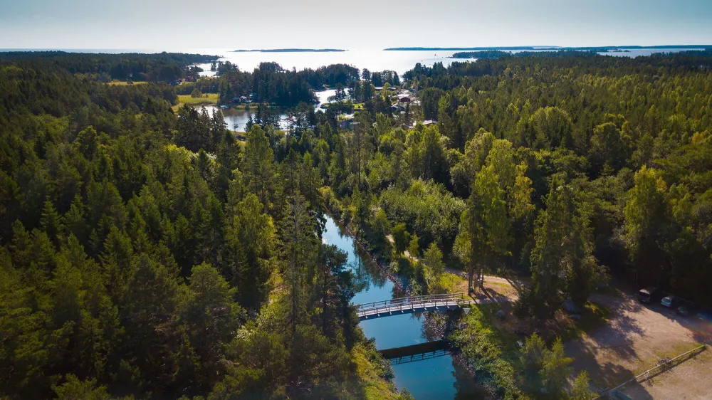
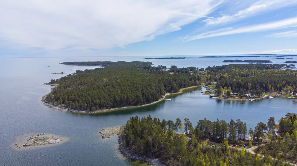
In the outer coastal region southeast of Söderhamn, you will find Skatön, which is directly connected to the mainland. The nature reserve covering the entire island is a fantastic outdoor area with opportunities for swimming and wonderful experiences in diverse and beautiful nature. The elongated island stretches far out into the open sea, offering visitors a chance to experience the enchanting archipelago of Söderhamn.
Skatön is a popular destination with great qualities and plenty to offer as an outdoor and nature area. In addition to beautiful beaches, the nature reserve features a varied landscape ranging from natural pine forests to meadows rich in flora. Typical species found in the meadows include orchids, meadow flowers, and marsh thistle. Around the forested island, there is a well-developed network of trails that are easily accessible.
An easily accessible island
Many visitors arrive at the island by boat and often head to the northwest side where there is a sandy beach with a pier, barbecue area, and toilet facilities. However, you can also reach the island by road via the bridge over Svartsundsrännan. On the other side, the path splits. Taking a left leads to the bathing beach and further up to the viewpoint at Skatberget. The path to the right meanders along the island, wide and easily accessible, eventually reaching the southeastern part where most of the cottages are located. At the southernmost tip lies Skatrevet, an important area for many birds. It is also the reason why visitors should avoid walking on the reef during the nesting season. Many migratory seabirds are often observed here during spring and autumn.
Viewpoint with traces from the Ice Age
From the top of Skatberget, the highest point on the island, you'll have a fantastic view of the island and the surrounding archipelago. In the east, the horizon is visible, while the gentle forms of the mountains in the inland of Hälsingland emerge in the west. When you stand on the rocky outcrops, you might wonder about the centimeter-deep grooves you see in the rock. These are traces left by the inland ice where stones frozen in the ice scraped against the rocks. The erosion caused by the ice can also be seen in another way on Skatberget. The side facing the sea has gently shaped rocky surfaces due to the ice's scraping and smoothing, known as the lee side. On the sheltered side, the formations are much more dramatic, with large boulders detached, creating high, sharp edges. You can even see several broken blocks further down the slope below the mountain, and from their shape, you can determine where they were once attached.
Effects of land uplift
On the northern side of the island, there are several large fields of boulders that bear witness to the land uplift process. As the land has risen from the water, the waves have washed away the soil, leaving behind only the coarse material. In some fields, clear beach ridges can be seen as a level difference, remnants of the highest shoreline formed during rough weather. Some of the boulder fields are now open, while others are sparsely covered with forest. The vegetation on the island also clearly indicates the influence of the waves.
The area is located 10 km east of Söderhamn and covers an area of 343 hectares. Skatön Nature Reserve is owned and managed by Söderhamn Municipality.
Attributes
- Digital screens
- Pets allowed
- Child friendly
- Close to nature
- Forest area
- Beach
- Kostnadsfritt
Attributes
- Digital screens
- Pets allowed
- Child friendly
- Close to nature
- Forest area
- Beach
- Kostnadsfritt

